


Londoners can now check how healthy their city is using an online program developed by UCL.
The map is colour coded, green indicates a healthier street whereas red indicates poor health and takes several factors into account – such as noise and air pollution.
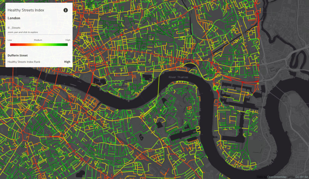
The program is called the “Healthy Streets Index” and is backed by Tranquil City, Healthy Streets, Casa and the Bartlett School of Architecture.
Factors that make a street healthier include pavement space and widespread greenery. The initiative is designed to help raise awareness over the health problems inner-city residents face.
Neighborhoods can vary widely over the healthiness of their streets; some of the most affluent areas suffer from drastic issues, whereas some of the poorest areas have some of the healthiest streets.
London is aiming to become a greener city and the council recently announced that Oxford Street, will be car-free by 2030, and Sadiq Khan, has recently announced all public transit will be zero-emission by 2050.
“There are many people living on streets which are not healthy enough, but there are also healthy streets in some of the poorest areas,” explained Lucy Saunders (Director, Healthy Streets). “The Healthy Streets Index shows at the city scale the challenge of creating Healthy Streets for everyone.”